Kit Talk

Sunday 11 January 2015

The Doon - 4th January 2015


Location -    Tynron start and end grid ref NX8092    Grid Ref for The Doon itself NX819939
Total distance - approximately 3.5 miles.  (but I will do this again with the garmin to make sure)
Surface   -  Track, then open hillside, grass and mud quite a lot of muddy and boggy patches.
What did we see   -  Sheep, cows, one wee mouse and the most amazing spectacle of the mist rising from the valley.
Susan's Rating - not as hard as it looks at first glance, but there is a short steep climb before the top. Beware of the wet areas however they are very hard to avoid, have been up in summer and it's less wet unsurprisingly.  Well worth the climb.

My friend Linda had been going on about climbing Tynron Doon for quite a few months.  She had been up before a long time ago, but wasn't sure she was still up to it.  However as she had no problem on the walk we did at Moniaive last week I felt it was time we headed on up; and  what better time to do it than the first Dog Walk Sunday of the year.  Arthur was really pleased too as this had been on his to do list for a while, so joined by Eunice and Digger we all set off on our big adventure.


Start point for us for this walk was the car park of Tynron Village Hall from there we followed the track which leads up from the church past the graveyard the way is signposted.  There are other ways onto the hill but this is my favourite at the moment.


The finger post is situated near Choo Campbell's memorial bench.  Follow the arrows and keep to the right hand track, not the one which leads uphill.

Keeping on this track we wound our way steadily uphill past the waterfall which was in full spout due to all the lovely rain we have been having lately ( the road splits again but take the left hand side and continue uphill).  We stepped out of the gate at the top of the track onto the hill and gave Linda a few moments to contemplate what she was about to undertake.

The view from the gate.  Granted on a nice Summer day - look at that sky.


Once though the gate we followed the track upwards then veered off to the right to cross the stream and through another gate.  Now this is where it gets fuzzy a bit.  There are tracks, you can see them quite clearly and it's just a case of picking your way across and up to the summit.  However we took a slightly zig zag approach to avoid some cows, we made sure to keep well away from them, not that they seemed bothered in the slightest.  I'm sure they are well used to people trudging about their home.  We weren't the only people on the hill and that was on a damp dreich day.

After several stops for photo taking and wee breathers we made it to the stop.  I rather think Linda was well pleased and Arthur was too. Needless to say the dogs had a ball.   Here are some pictures taken from the top.


Wee Breathers LOL

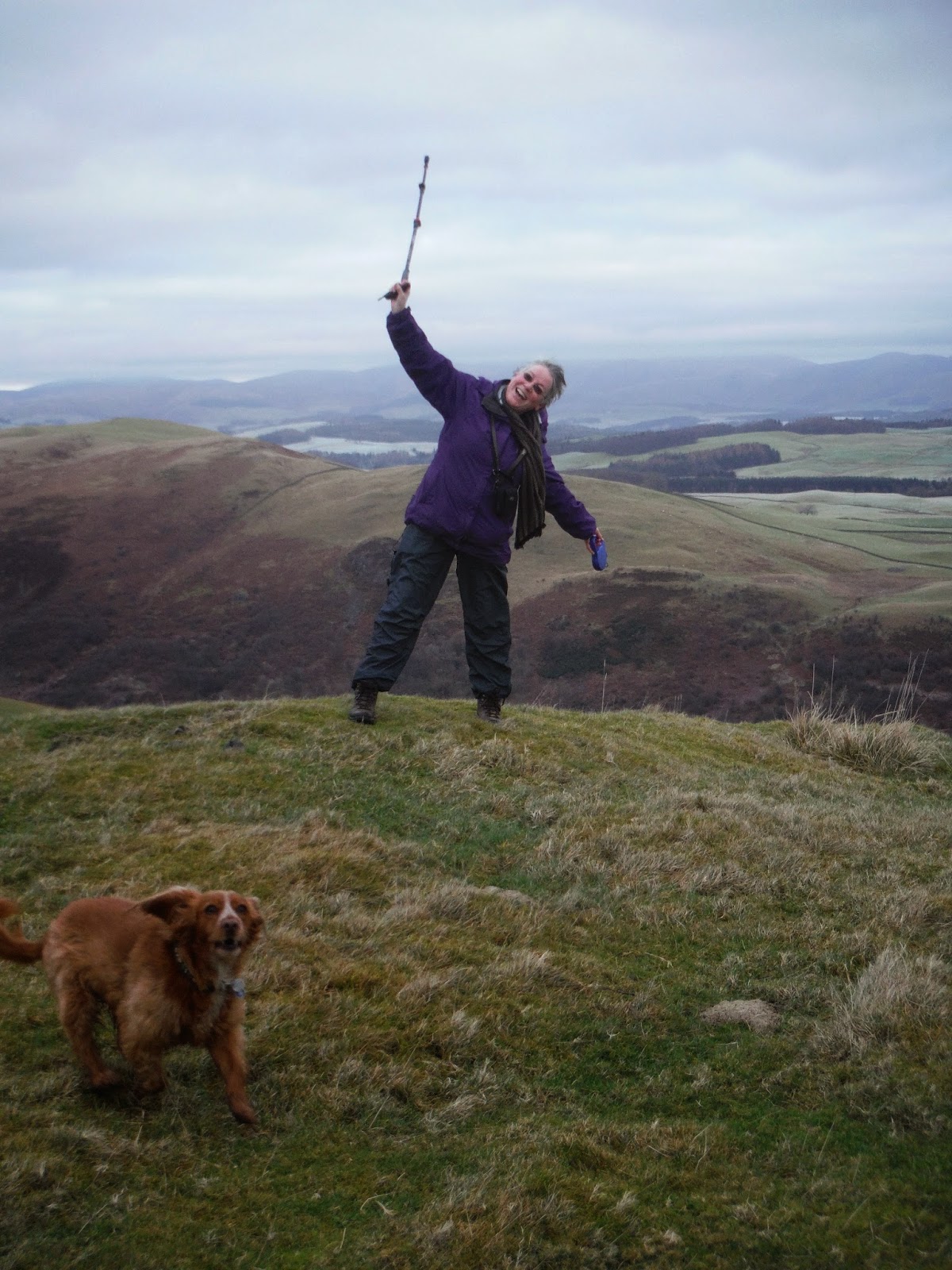
Did I say I thought Linda was well pleased.

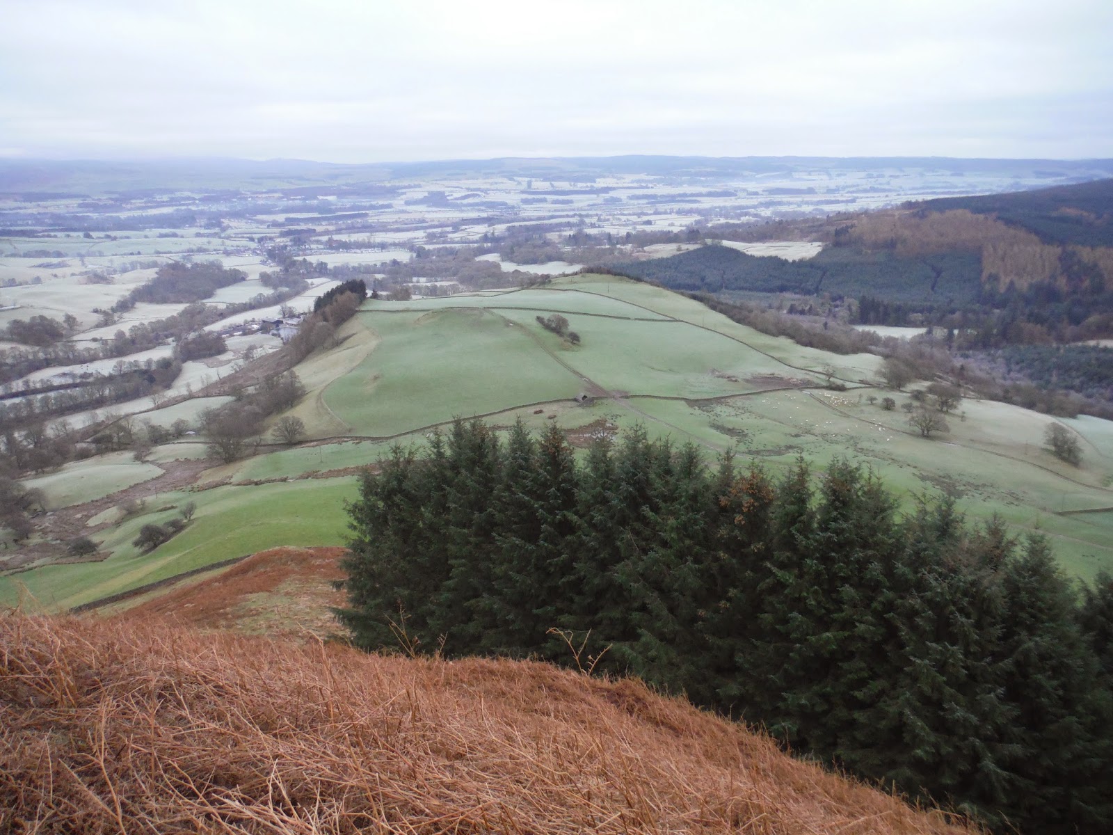
Nithsdale in all her glory.

Kona


This tickled us pink we watched it for quite a while.


 Tynron Doon or as some call it "The Doon" is not the highest hill in the area at 291m (955 ft) but I feel that it has some of the best views.  You can see an awful long way in all directions and we spent some time figuring out where we had been on previous walks and where we would like to explore on future walks.


 Arthur Meg and Spot on their way back to the car park.  Kona seems determined to beat them to it.

If you are interested in history here's a link to a page which tells you a little about the hillfort. 
http://www.megalithic.co.uk/article.php?sid=24108

At the end of the walk Arthur had to leave us, so Linda, Eunice and I spent some time looking round the graveyard and the outside of the Church.  I've lived in this area all my life and this was the first time I've been up to and around the church.  Eunice says that there are some fine stained glass windows in the Church and as I have an interest in Stained Glass windows I hope to get to see them soon. 


Friday 9 January 2015

Rounding off 2014.


Ae Forest Adventures

My friend Lorraine and I had a lovely wander round Ae with our dogs on Hogmanay (during the day I might add not when the bell's were ringing) It was a brilliant way to round off 2014.  As with my Drumlanrig Walks blog I'm not going to outline one specific route but put up some of my pictures taken on various walks in Ae over the past year.  Ae Forest is one of my favourite places, It's an excellent place for walking, running and mountain biking - all of I have participated in during the year. 

Me trying out my map skills.
Ae Village itself has the claim to fame of having the shortest place name in the United Kingdom, it also has one of the largest forests too.  Nearest postcode is DG1 1QB
Car park grid refs are:
First car park nearest the cafe'   NX 984 894 and second car park nearest the trails with room for parking a horse box or large vehicle ie camper van mini bus etc NX 983 902

Talking of cafe's the one here is excellent and has a Mountain Biking supplies shop attached.  There are also shower facilities available for a small charge.  The shop has shorter opening hours in the Winter months so could be a good idea to check before you head up there if you wish to have something to eat.   I purchased a waterproof map of the forest from the cafe' for £2.00 which folds up small and can be easily popped into a pocket.  These may not always be available however so it might be best to be prepared in advance .  The trails are all posted and signed according to use.  Just be careful not to stray onto the MTB single track areas.  The Forest is there for everyone to enjoy as long as we exercise some common sense and not put ourselves or others in danger.

Keep dogs under close control, and pick up after them.  

So here are a few photos to give you an idea of what to expect.


The first two are taken from the low level route, very easy walking.

Looking back to the village from the road leading to the car park.

Just one of the delicious drinks available from the cafe' just what you need on a cold Winter day.

Christmas Santa Run 2013


This photo and the one above are taken from a higher level walk which does involve a bit of uphill walking, the views are brilliant though and well worth the effort.


Hope you feel inspired to go along to Ae.  Here are a couple of links to some further information.

http://scotland.forestry.gov.uk/visit/forest-of-ae
https://www.facebook.com/AeBikeshopandCafe