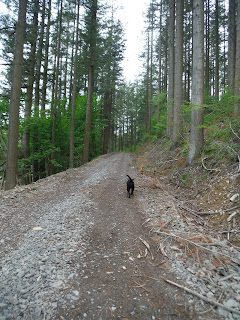
A gem of a wood with the most wonderful views from the viewpoint.
When we were there some felling and path repair etc had been being undertaken. I would imagine this walk will be even nicer when everything settles down again.
( I started putting wee silly titles on the walks, now I feel I have to carry on. Will have to get my thinking cap on.)
Date of walk - 24/5/15
Start Location - Forestry Commission Car park situated just off the B736, 3 miles from Castle Douglas. Grid Ref NX79408 57786.
Surface - first half, fairly uphill, in fact could be steep for some, there is a small detour up to the viewpoint which is uphill through the trees, the second half which is downhill, with a few undulations is varied. As I said above there has been quite a bit of felling and path repair going on here, which you may see in the photographs. Towards the bottom of the hill the path becomes a bit rougher with some rooty places, take care.
What we saw - the most amazing panorama from the viewpoint, Heston Island, Screel, Bengairn and in the distance (on a good day) the Lake District. It states in the information I downloaded from the internet before we went that there is an infromation board at the viewpoint, at the time of writing this has sadly gone, but it may be replaced at some point. Doach is also home to some of the tallest Douglas Firs in the country, the sheer height of them takes your breath away. Missed the waterfall on the way up so I plodded back up to get a photo.
Susan's Rating - a short walk, perhaps about 3 miles, moderately easy once the initial climb is out of the way. It says in the information that it takes about 2 hours, we did spend about that time there, probably even more as we spent a while at the viewpoint and some more time exploring round the route. Oh and taking photos.
We took the uphill route which was on our left hand side when facing into the wood from the park park. It goes steadily upwards, past the waterfall which we somehow managed to miss. About half way up this road it bends very sharply to the right and continues up. In a short while we came to the detour up to the viewpoint. This is marked but we weren't sure, as the marker posts didn't quite match up with the descriptions from the internet so we asked some passing people. I think the posts have been replaced with new ones since the article was written. Anyway if you start going downhill, you've missed the turn off so go back and have another look.
 |
| This photo courtesy of Linda Airley. |
We spent quite a while up here, taking pictures, there are a couple of benches/seats and I do hope they manage to put up a new board soon. Once satisfied we had seen everything and taken in the beauty of the place we headed back down onto the forest fire road and continued our journey downwards.
I think this was my most favourite part of the walk, it reminded me of Kielder (a place I love). You can see the new improved path.
If you have ever wondered why some trees and stumps are left when there have been felling operations, then here is your answer.
A brilliant idea from the Forestry Commission which explains the reason it appears to be a mess
Very nearly at the bottom, the picture doesn't really do the sheer size of these trees justice.
Information from the Forestry commission.
We rounded our day off by visiting the Red Kites at Bellymack Farm. To say I was a little bit excited about this is an understatement.
http://www.gallowaykitetrail.com/item-38-bellymack-hill-farm-kite-feeding-station


