Loch Ettrick to Clauchrie Lay by.
Saturday 14th February 2015
Start Location - Loch Ettrick Grid Ref NX 944 936
Finish Location - Clauchrie Lay by Grid Ref NX 912 885
Total Distance 6 1/2 miles. (from Garmin Oregon GPS).
Surface - Predominantly Forest Fire Road - easy walking even when wet.
What did we see - obviously lots of trees, however not all forestry trees lots of variation. Quite a few Buzzards, Sheep, spring flowers, catkins and some stunning scenery. Met absolutely nobody whilst out and about today.
Susan's Rating - very pleasant walk, easy going and for the most part downhill until you come to Clauchrie and then it undulates for about a mile and a half. This is why we did it this way round.
For this walk we employed the services of my long suffering husband to drive us to Loch Ettrick and pick us back up from the lay by at Clauchrie. For the really energetic not averse to walking on roads, it is possible to park your car at Loch Ettrick or Clauchrie and do a complete circuit by walking back along the road through Park and up to Loch Ettrick, just don't ask me at the moment how much this adds. I may do this at a later date though.
Word of warning.
Just be aware that mobile phone coverage can be sketchy to say the least in the forest. So if two or more people are heading out check your provider and all the better if they are different. Make sure you are fully charged up too. Always leave a note or tell someone of your start point and destination and estimated time of arrival.
Back to the adventure -
This walk was an outing to see what sort of route/journey two of our sort of favourite forest walks would make when joined together as one fairly longish walk.

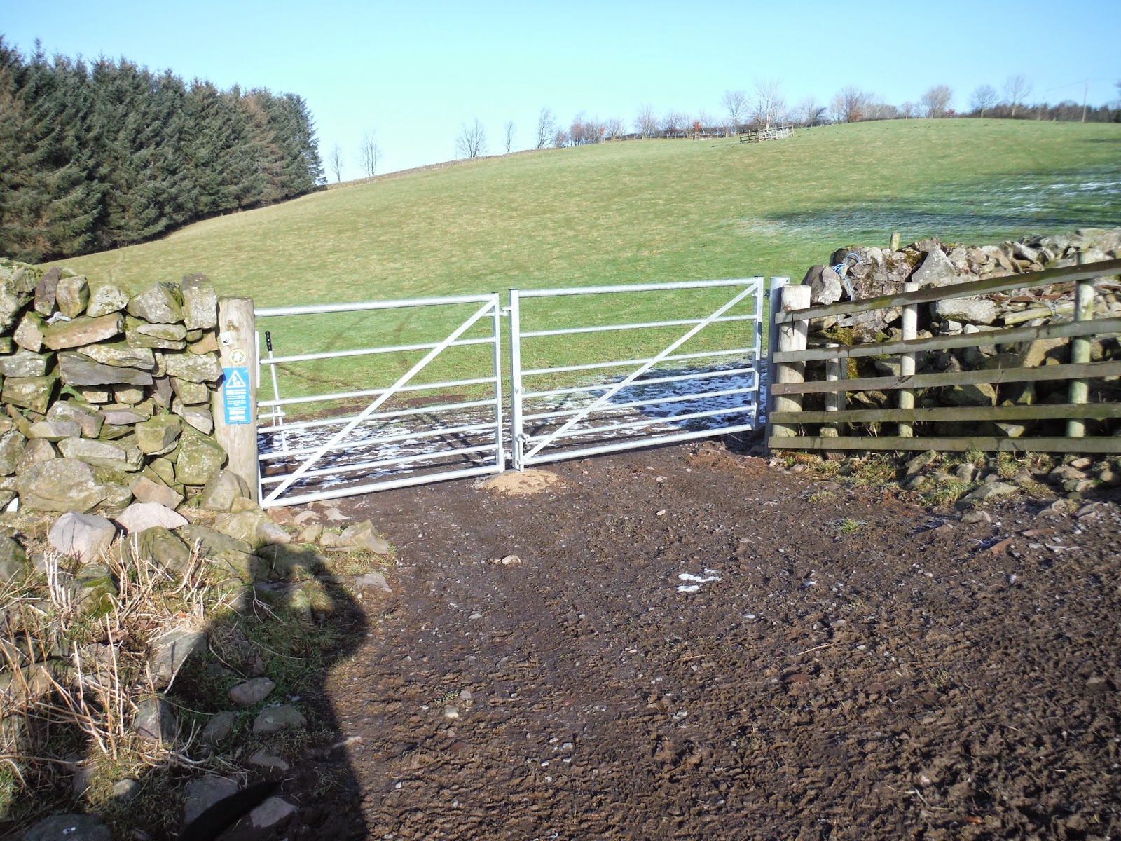
We started at Loch Ettrick and made our way to the location of the mast.( If you keep on the road and go straight, don't take any of the off shoots then you will arrive at a cross roads NX 937 921 the mast will be on your left on the top of the hill. You can make a detour to have a look of you want, on a nice day there is a really good view of the surrounding countryside. You can also make a round trip here which will bring you back onto the fire road heading back to Loch Etrrick Lay by and this is a lovely walk in itself (approx 4 miles). ) However today we carried on going slightly uphill and by following the road round to the right it brought us out onto Gawinmoor, keeping on this track we just kept going slightly downhill until we came to the new sign posts put in place by the core paths people. We passed them and again kept going downhill (more pronounced) this time, until we reached the gate at the bottom of the forest. We carried on downhill by keeping the forest to our right hand side and the fields to our left, there are large piles of stones in the field so when we saw those we knew we were in the right place.
The photos apart from showing what the walk looks like etc serve the function of illustrating the route and general direction. I would advise anyone walking in the Forest to take a map, not only for route finding but also a map shows where there are bits and pieces of interest along the way, there are quite a few cairns marked up in Auchencairn and these will probably be the focus of another wee adventure for me soon. The grid refs on my blogs are taken directly from the wonderful OS Get a Map pages. You don't need to subscribe to see the mapping functions but if you do subscribe you can print off maps to suit your own needs. I find it brilliant for making my own route cards and things. Can spend a good long while just pottering abut with it really.
 |
| At the mast junction - take the Uphill Road for this particular route. |
 |
| Head along here, road drops down hill to a righthand bend. |
| Not the clearest pic, but this clearing is on the left. |
 |
| Just love this section. Look out for the Look out tower. |

 |
| Stones in field on your left side going down. Photo Linda Airely. |
 |
| Gate Leaving forest (this is taken from the other side) |
Leaving the forest by the gate we headed left and up lane to Auchencairn Cottage gate, from here it was just a case of following the core path signs down hill to the start of the Clauchrie Plantation. Before we crossed the wee wooden bridge we stopped for a short picnic, out came the coffee and shortbread. Kona and Tess duly mugged us for treats.
 |
| Me (Dora the Explorer Mode) and Tess Auchencairn Cottage Road. |
 | ||
| Kona Heading down to Clauchrie. |
However here is one of Linda's.

Just a reminder to any readers (if there are any) that these are my walks, I blog them for me (and Linda) they are not prescriptive in any way. If they give inspiration then fine, but go out walk, make your own routes, but always be aware of your surroundings take note of where you are and how to get back to where you started.